CartographeRs’ AtlaSes
mprove design :: 2020
![]() Work in progress –– ChronoButton labels need to be updated b/c now they open the entire cartographer’s atlas!
Work in progress –– ChronoButton labels need to be updated b/c now they open the entire cartographer’s atlas!
/new feature 12/2020
![]() Power feature: Use key W to proceed (walk) to the next ChronoButton. Press Q to move backwards.
Power feature: Use key W to proceed (walk) to the next ChronoButton. Press Q to move backwards.
Early Atlases
1375 Portulaan 1527 Agnese Battista 1542 Lucas Waghenaer 1586 Portolan 1590
Cartographers
–sorted roughly by time–
Claudius Ptolemæus
- Claudius Ptolemy (c100 – c170)
Chronoscope’s oldest map is Ptolemæus’ page about the Adria – drawn in c1250:
Leonardo Da Vinci
- Leonardo Da Vinci (1452 – 1519)
Usually not known as a cartographer – but is there anything a genius like Leonardo can not do?
Johannis Meyer
Georg Braun/Frans Hogenberg
Sebastian Münster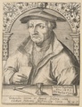
Mitnächtige Länder 3 maps
Johannes Janssonius
Atlas ou représentation du monde universel et des parties d'icelui, faicte en tables et descriptions très amples et exactes, divisé en deux tomes.
Matthäus Merian
Die Topographia Germaniae von Matthaeus Merian – Die Erzbistümer Mainz, Trier und Köln, Online-Ausstellung der Uni Trier
Nicolaum Visscher
- Nicolaes Visscher (1618 – 1679)
and his son Nicolaes Visscher II (1649 – 1702)
13 maps, e.g. Flandern 1690
Johannes Van Keulen & his son Gerad Van Keulen
Iohannes Babtiste Homannus
- Johann Homann (1664 – 1724) and the company Homanniani Heredes
33 maps, e.g. Russia 1715
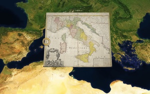
30 maps by Homannianis Heredibus e.g. Italy 1742
![]() Chronoscope’s Atlas provides access to collections of maps. Use the button in the Chrono-Bar or the keyboard shortcut A to select a map.
Chronoscope’s Atlas provides access to collections of maps. Use the button in the Chrono-Bar or the keyboard shortcut A to select a map.
Jean Cóvens & Corneille Mortier
5 maps, e.g. Mantua 1700![]()
Justus Danckerts
Jean Jacob Scheuchzer
J. G. Schreibern
Matthäus Seutter
- Matthäus Seutter (1678 – 1757)
Seutter has learned the craft of cartography at the company of Johann Homann. He moved back to his home town Augsburg to start his own map making company.
30 maps, e.g. London 1741
Petrus Schenk
Pieter Schenk
A.F.W. Crome
Benjamin Baker / Franz
Otto Hasenbanck
Gabriel Bodenehr
Thomas Jeffrey
Joan Blaeu
C.W. Gerlach
Heinrich K. Berghaus
W.B. Clarke
- W.B. Clarke (1806 – 1865)
e.g. Dublin 1853
John Felix Jones
M. Riedig
William Lindley
Wasserkunst und Eisenbahn für Hamburg
- Hamburg Bergedorfer Eisenbahn /Polytechnisches Journal. 1. 1838; 17.11.1838; 6 Seiten
- Deiverse Artikel zum neuen Sielsystem /Neue hamburgische Blätter 1843
- Zum Abschluss der Wasserkunst Hamburg, 1848
- Proposita in forma Stadtwasserkunst, 1848
- Biographie William Lindley 1866
- Sielsystem in München; 1869
- Wasserwerk in Warschau
Jules Verne
John Snow
James Wyld
F.v. Stülpnagel
Georg Michel Bauerkeller
Xaver Imfeld
Hans Steffen
- Hans Steffen (1865 – 1936)
e.g. Patagonia 1913
Max Uhle
- Max Uhle (1856-1944), archaeologist and linguist
Pharus-Pläne
Erwin Raisz
- Erwin Raisz (1893 – 1968)
15 maps, e.g. From Lubeck to Milan from the 1960s
Kai Krause
The True Size Of Africa by Kai Krause
Just a reminder that the Mercator projection – also used by the Chronoscope – does a terrible job to preserve the relative sizes of countries and continents. In fact Greenland’s north-south distance is only 1.7 times the distance of Madagascar;
2,650 km for Greenland vs. 1,600 km for Madagascar
DataVisualization
Alexander von Humboldt
e.g. Ein Naturgemälde der Anden 1807
Charles-Joseph Minard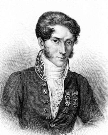
e.g. Napoleon’s war against Moscow 1869
Tableaux graphiques et cartes figuratives (55 pages)
Minard-style
- Road from Cuxhaven to Harburg (1930)
- Railways & waterways of Holland (1935)
More Projects by the Chrono Research Lab
Chronoscope World – interactive time-travel on More than 4,000 historical maps Lucky Map
> Chronoscope World Tour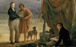
ChronoAlex – Alexander von Humboldts Erforschung der Neuen Welt