Tracing Max Uhle
An expedition of Max Uhle; mprove design 8/2020
Max Uhle created a log scratch book on his trip in Peru. 9 pages have been mapped to a satellite view of the region. Follow his trail accoding to the notes on his map.
![]() Use PageDown or key W to walk to the next marker.
Use PageDown or key W to walk to the next marker.
| Time | Place | Measurement | Comment | |
|---|---|---|---|---|
Lomas to Nazca |
||||
| mmHg (temperature?) | ||||
| I | 7.24 | Lomas | 762.5 *764.5 (19.8) | page 4 |
| 8.0 / 8.3 | ||||
| 8.40 | 755.2 *768 | |||
| 9.20 | ||||
| 9.45 | ||||
| 10.35 | 734 *740 (21) | |||
| 11.30 | AlJahuay | 743.3 *750 (20.5) | 400m above sea | |
| II | 5.30 | 741*749 (15.3) | (next day) | |
| 6.15 | 731 *738.5 | |||
| 8.0 | 719.5 *730.5 (19.5) | |||
| 8.40 | ||||
| 9.20 | ||||
| 9.55 | ||||
| 10.20 | page 3 | |||
| 11.15 | ||||
| 12.10 | ||||
| - | 707.3 *718 (23.3) | page 2 | ||
| 1.10 | ||||
| 1.35 | ||||
| 2.30 | *722 | |||
| 3.45 | Poroma | |||
| III | 9:30 | (next day) | ||
| 12.40 | Tunga | |||
| IV | 8.20 | (next day) | ||
| 10.35 | Machaverde | |||
| 11.0 | page 8 | |||
| 12.5 | junction south of Nazca | |||
Nazca to Trancas |
||||
| 7.40 | Nazca | (which day?) | ||
| 8 | junction south of Nazca | |||
| Taruga | page 2 | |||
| Trancas | ||||
Usaka to Nazca |
||||
| Usaka | page 7 | |||
| 3.10 | afternoon? | |||
| 3.45 | Tambo | |||
| 4.42 | ||||
| 4.58 | page 8 | |||
| 5.p | 7.50 | (next day?) | ||
| 9.0 / 2.45 | Cahuatchi pilgrimiage center wiki | |||
| 3.5 | Las Cañas | |||
| 4.25 | Soisongo Soisonguito | |||
| 5.0 | ||||
| 5.20 | Angia | |||
| 6.45 | 711 *723 (24.7) | (new day?) | ||
| crossing the Lizard Tree 360 Hands 360 (not yet discovered) | ||||
| 8.25 | ||||
| Maria Reiche museum and grave | ||||
| 9.32 | San José | 731.3 *738 (25.5) | ||
| Hummingbird 360 | ||||
| 10.5 | ||||
| 10.25 | page 7 | |||
| 11.45 | ||||
| 12.25 | Chillo | |||
| 1.45 | ||||
| 2.35 | Huayuri | |||
à propos
- Maria Reiches live and work
- Fotostrecke im SPIEGEL (mit einigen sachlichen Fehlern)
- Maria Reiche's Line to Archaeoastronomy; Amelia Carolina Sparavigna 2013
- maria-reiche.de
- MapCarta
- Remembering Maria Reiche, who devoted her life to investigating Peru’s Nazca Lines; 2018
- Carmen Rohrbach: Botschaften im Sand; 2000
- Tatort Peru – im Bann der Nasca-Linien; ZDF TerraX (44 min)
- Katze (Spiegel 18.10.2020) | Cat Guardian (18-Oct-2020)
More projecs of the Chrono Research Lab
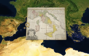
Chronoscope World – interactive time-travel on More than 4,000 historical maps Lucky Map
> Chronoscope World Tour
> Cartographers
ChronoVolcano3D
ChronoAlex – Alexander von Humboldts Erforschung der Neuen Welt
Hamburgs Eisenbahn
> Salpeterhandel mit Hamburg
By Matthias Müller-Prove. Created: August 2020, Modified:
8/9/23