ChROnoVoLcanO
Hotspots on Planet Earth
We live on a hot liquid rock with a thin crust. The surface of Planet Earth is formed by tectonics and bubbling hot lava during millions of years. Here are a couple of hot spots visualized with the Chronoscope World.
Europe – The Atlantic – America – Pacific – Asia
The Atlantic
Pico del Teyde on Tenerife
- Altitudinal zonation of vegetation forms at Pico del Teide on Tenerife Timewarp Alexander von Humboldt 1817 /via ChronoAlex
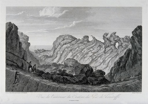
Crater view at Pico del Teide | Perpsective | Teide
La Palma at the Canary Islands
Europe
Laacher See Lake Laach /last eruption about 12,900 years ago.
Dragney is a 700,000 year old volcano in Iceland. Well, the remains of the volcano.
Jules Verne’s science fiction novel Journey to the Center of the World starts at Snæfellsjökull on Iceland – while Stromboli provides the exit of the cave system.
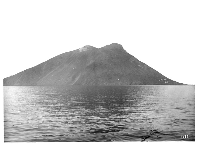
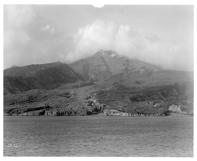
HAPAG Ahoi! Stromboli ca. 1909 (2 photos) Perspective
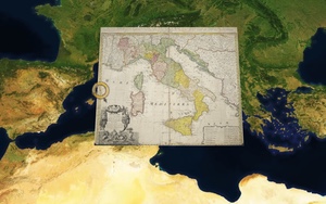
- Italy has several cold and hot volcanos; for instance the crater lakes:
- Lago di Bolsena Lago de Bracciano ol Vulcanus Sabatinus Lacus et Vulcanus Albanus
Mount Vesuvius destroyed Pompeii in 79 A.D. City plan
The vulcano is still active:
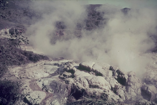
HAPAG Ahoi! Vesuvius ca. 1938 (7 photos)
Mount Etna Aetnae in Sicilia 1707
americA
Mount Pelée on Martinique Perspective
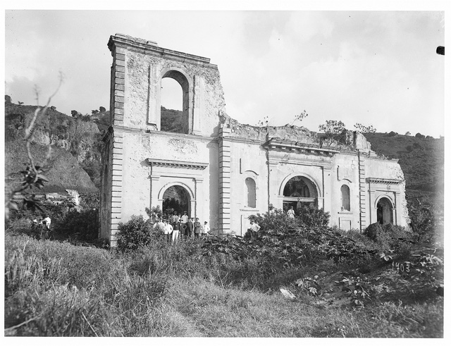
Ruins of Co-Cathedral of Our Lady of Assumption on Martinique after the eruption of 1902 Perspective
/via HAPAG Ahoi! #St. Pelée (8 photos) on #Martinique (34 photos) ca. 1909 #
Jorullo in Mexico satellite view of Jorullo Jorullo 1845
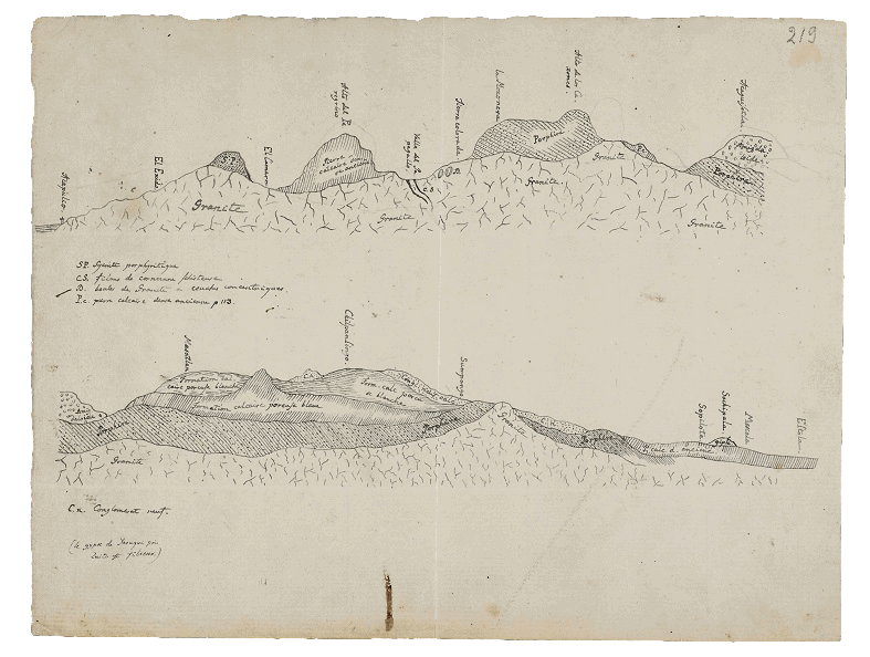
Geognostische Schnitt entlang des Weges zwischen Acapulco und Mexico-Stadt /via
Vulcanos in Ecuador 1894 Vulcanos in Ecuador 1897
Gipfel des Cotopaxi 5753m. Wenige electrische Explosionen mit Donner begleitet. –Humboldt
Gipfel des Chimborazo 6544m; die gemessene Basis durch Laplace’s barometrische Formel auf die Meeresfläche reduciert. – Viele leuchtende Meteore. –Humboldt

Humbold und Bonpland am Fuß des Chimborazo; von Friedrich Georg Weitsch (1810) /via
Quer_Profil durch das Hochland von Quito
Tiefenprofil von Santiago nach Buenos Aires
Pacific
On the ring of fire…
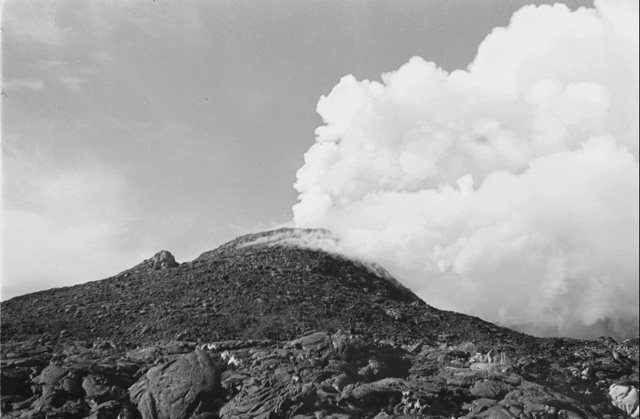
Miyakejima – South of Japan
South-east Asia
Things I believe but cannot prove… Gilibanta Island
- Smithsonian Institute has no evidence for an eruption of Gilibanta for the recent 10,000 years. However, I believe that a vulcano eruption has significantly reshaped the island after 1835. Some historical maps support this hypotheses; but are they accurate and reliable? A map from 1835 shows Glibanta with a convex shape:
- Gilibanta Island 1835
- Gilibanta – side map 1835 even with a »Pik«. Where is the peak today?
10 years later the shape is slim and concave; similar to the current outline:
Maybe the map from 1858 was not updated yet:
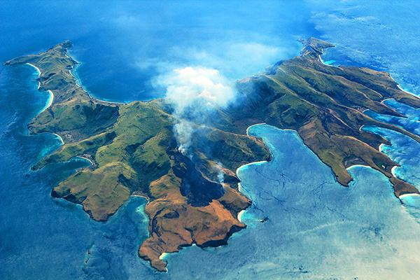
Gili Banta Anchorage, Indonesia /a drone flight 9/2018
Next West: Gunong Api has two peaks
Plenty of smoking volcanos on Java
Bonus
 Erwin Raisz (1893 – 1968) has drawn a set of geological illustrations about the upper layers of the Earth.
- From Ireland through England
- From Lubeck to Milan
- Click the map an proceed with key W
Bonus 3D
– Feb 2021 –
This interactive trip to some hot spots of the world is also available in 3D. ChronoVolcano 3D is an interactive round-trip to some volcano sites.
à propos
- Smithsonian Institute – Global Volcanism Program
- A meteor impact crater around Nördlingen maybe the only town in the world built using materials of extraterrestrial origin. Parts of a large meteorite that formed the crater it sits in was used for building the city walls, town houses, churches, … /via
More Projects by the Chrono Research Lab
Chronoscope World – interactive time-travel on More than 4,000 historical maps Lucky Map
> Chronoscope World Tour
> Cartographers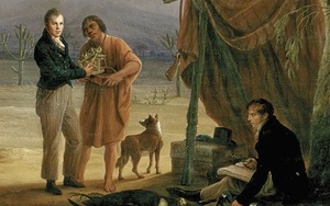
ChronoAlex – Alexander von Humboldts Erforschung der Neuen Welt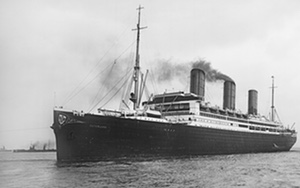
HAPAG Ahoi! – travel photography 1909-39
> Oswald Lübeck Kontaktabzug
> Franz Grasser Kontaktabzug